
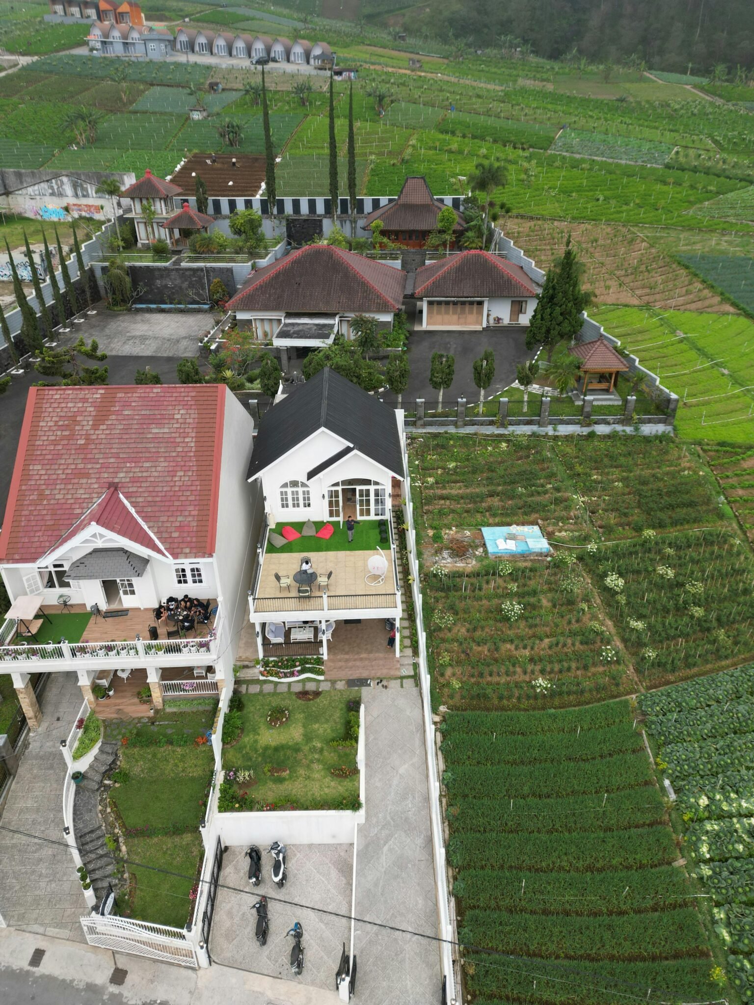


From the rooftop, a drone’s eye view is rewriting how homes are shown and sold. In minutes, a single flight can replace hours of on-site visits and multiple photo shoots that used to cost a small fortune.
What started as eye-catching marketing has become a practical toolkit for the entire real estate lifecycle. The drone real estate workflow now blends aerial footage with interior shots to deliver cinematic tours that engage buyers and speed decisions.
Recent Trends
- Cinematic virtual tours rise in listings
- Drone-powered roof and exterior inspections grow
- Photogrammetry enables fast land surveying
Beyond marketing, drones are being employed for roof surveys, exterior inspections, and fast land surveying. These capabilities reduce risk for agents, sellers, and buyers while cutting timelines and costs.
In the band of terms that define this shift, four phrases show up repeatedly: aerial photography, property inspections, roof surveys and virtual tours. Each contributes to different stages of a deal, from marketing to due diligence.
According to Techbullion, the momentum comes from brokers who want transparency and speed. Industry voices cited include Pavel Khaykin and Zack Moorin, who describe how aerial imagery can attract out-of-town buyers and shorten cycles. Jonathan Carcone, founder of 4 Brothers Buy Houses, notes that drone real estate tools save time and extend reach for listings.
Cinematic Tours Drive Engagement
One-take drone walkthroughs from street to backyard create a seamless experience that ground photos struggle to match. When paired with interior shots from a steady camera like Steady Series, the result is a professional tour suitable for social media, listing sites and virtual showings. The format gained traction during periods when on-site viewings were limited, and buyers grew accustomed to touring from anywhere.
Inspections and Maintenance
Drones shine in maintenance workflows. Roof inspections become safer and faster with a ground-based operator staying out of harm’s way while the drone captures close-ups of chimneys, gutters, and flashing. Some platforms also carry thermal cameras to spot heat losses or moisture behind walls. The data is clear, supporting repair estimates and insurance claims.
For developers, drone-based surveying and photogrammetry deliver precise 3D models and topographic maps in minutes rather than days. This capability helps identify property lines, plan layouts, and accelerate acquisitions.
Adopters cite cost savings and improved safety as primary drivers. Mike Otranto, owner of Wake County Home Buyers, says regular drone inspections help catch issues early, extend building life, and provide crystal-clear visual proof for repairs or insurance claims. Property managers find the approach appealing: it lets them monitor large complexes without risky on-site visits. For readers, the takeaway is simple: invest in a workflow that pairs marketing visuals with concrete maintenance data to close deals faster.
As drone real estate scales, pros must align with local rules and FAA guidelines. Training, data handling, and privacy considerations are essential to avoid friction with neighbors and regulators. Real estate teams that design compliant, digestible workflows will lead the market in the next phase of adoption.
Conclusion
Drone real estate is transitioning from novelty to necessity. Combining compelling marketing with proactive maintenance data creates faster, safer, and more transparent transactions—and that mix is reshaping the competitive landscape for brokers and builders alike.


