
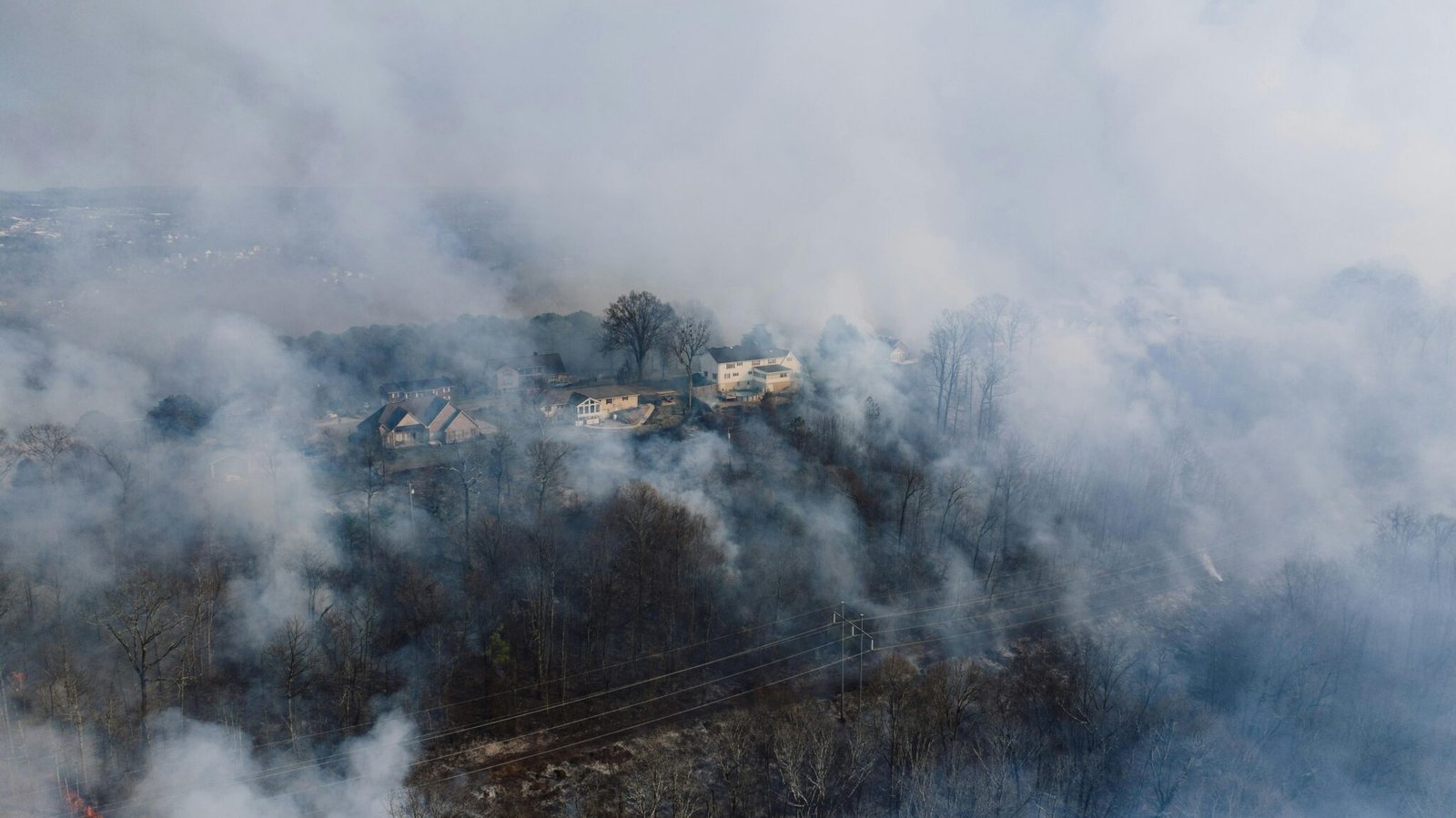


Smoke curls over Hong Kong’s hills as a drone hums into view, its AI eyes scanning heat signatures and the ghost of smoke skimming the skyline. The scene reads like a routine test, but it hints at a shift: smart air scouts may cut response times when wildfires flare up in densely populated areas and rugged terrain.
Recent Trends
- AI-assisted wildfire surveillance grows near urban forests
- Drone data rules shaping emergency operations
- Real-time data sharing boosts incident response
LifeSparrow, a Hong Kong–based startup highlighted by CNN, is developing an AI wildfire drone platform aimed at spotting fires while they are still small. The patrol drone pairs a compact UAV with advanced computer vision and thermal imaging, allowing operators to distinguish hot spots from ordinary ambient heat. In practice, this AI wildfire drone can shorten the loop between detection and dispatch, offering incident commanders a clearer picture in the critical first hours of a blaze. This kind of capability also supports drone wildfire detection efforts across challenging landscapes and is a clear signal of what the next generation of aerial observers can deliver.
At its core, the system relies on onboard processing. Instead of streaming every frame to a distant server, the drone analyzes video and infrared data on the fly, flagging potential hotspots that human crews might miss in dense urban terrain or rugged parkland. This approach reduces latency, which is the enemy of effective wildfire response. CNN notes that the LifeSparrow team envisions integration with existing emergency protocols, so responders can receive alerts with geolocation and heat maps that illuminate the most urgent fire fronts. The emphasis is practical and scalable for real-time aerial imaging workflows that many emergency services are already trialing.
According to CNN, the AI wildfire drone uses onboard AI to analyze infrared imagery and video in real time, helping crews pivot quickly to hotspots and containment lines. The technology promises fewer false alarms, quicker triage, and better coordination among ground teams, drones, and watercraft deployed to protect neighborhoods near coastlines and hillsides alike. For operators, this means a tighter feedback loop: faster decisions, better resource allocation, and safer operations for frontline personnel.
Why this matters for the industry
Wildfire prevention and early detection have moved center stage as climate pressures push fire seasons longer and more unpredictable. An AI wildfire drone like LifeSparrow’s brings a tangible proof of concept: smart sensors, real-time analytics, and mobile platforms that can be deployed where traditional air support is thin or delayed. For drone operators and manufacturers, the appeal is clear. AI-driven inference on the edge means lighter payloads, longer flight times, and faster decision cycles for responders. This capability aligns with broader trends in safety and rescue drones that aim to extend human reach while reducing risk.
Beyond pure firefighting, the same technology ecosystem could enable safer inspections of electrical infrastructure after storms or during heatwaves. Drones equipped with AI wildfire drone capabilities can scan transmission corridors for hotspots that precede outages, or support search-and-rescue missions by rapidly mapping heat sources in sprawling terrains. In short, the trend is toward more capable, more autonomous airborne observers that help authorities act before a blaze explodes, and it dovetails with ongoing efforts in real-time surveillance and incident command modernization.
Regulators and industry groups will monitor how data is collected and shared. Privacy concerns, airspace rules, and data ownership will shape adoption timelines. Public-safety use often wins when clear demonstrations of effectiveness align with proven safety practices. In this sense, LifeSparrow’s progress provides a useful signal for the broader market: the next generation of drones is as much about smarter decision-making as it is about flight hardware. For Hong Kong robotics ecosystems, this development showcases the potential of local innovators to push global discourse on resilient, AI-powered tools for crisis response.
For readers, the takeaway is simple: if you chart disaster response in the age of AI, look for systems that blend fast on-board analytics with strong field integration. The promise is real: real-time situational awareness that can shorten response windows and save lives. For emergency planners, the message is unmistakable: smart drones paired with robust data pipelines can turn hours into minutes in critical operations.
What comes next
Experts expect more pilots and trials as agencies test how AI wildfire drone platforms perform across different terrains and weather. The Hong Kong example could serve as a blueprint for nearby cities facing similar wildfire risks, as well as for international markets seeking resilient, scalable solutions for disaster response. As the technology matures, we could see broader adoption in municipal fleets and cross-border cooperation between agencies and drones developers who specialize in defense-grade reliability for civilian uses.
Conclusion
As climate challenges grow more acute, the appeal of AI-powered drones for early fire detection is rising. LifeSparrow’s approach—edge AI, real-time analytics, and tight integration with responders—offers a practical blueprint for turning data into faster, smarter action on the ground.


