


A drone over a sun-warmed field can redraw a landscape in minutes, turning complex terrain into usable maps before a coffee cools. That pace of insight is what India may gain with a new autonomous mapping system from NIT Rourkela.
Recent Trends
- Rise of on-board AI processing in drones
- Digital India land records modernization gains
- Drones expand in agriculture and disaster response
Real-Time Land Mapping Goes On-Board With India\’s NIT Rourkela Drone
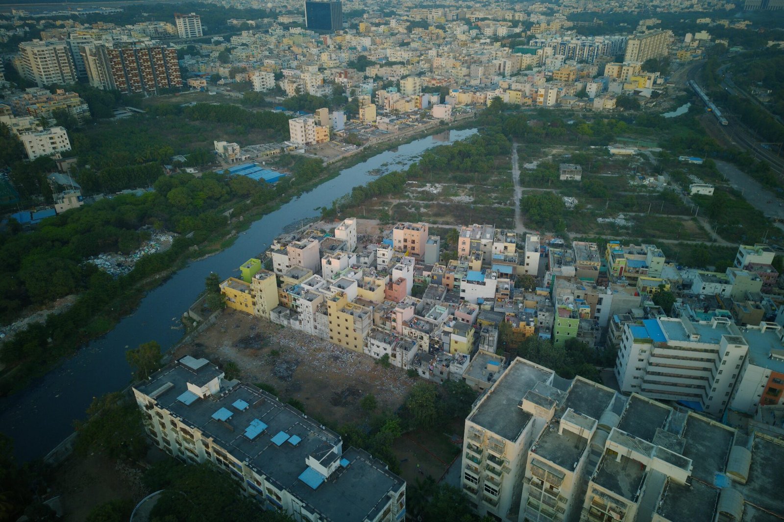
NIT Rourkela researchers have patented BHU-MANACHITRA, an autonomous drone system designed to create land maps in real time. The device is built to operate without internet access, external computers, or manual field support, enabling rapid mapping in remote regions and disaster zones.
The team emphasizes that the drone can identify features such as crops, forests, roads, buildings and urban areas on the fly, transforming planning workflows from weeks to minutes. The on-board processing means data stays with the drone, a feature that boosts resilience in areas with spotty connectivity.
According to Asianet Newsable, the BHU-MANACHITRA system combines Artificial Intelligence with Unmanned Aerial Vehicle technology to map land features on the spot, delivering real-time outputs as the drone flies over terrain. The developers also highlight a lightweight AI model with about 2.48 million parameters able to run on a compact processor carried by the drone instead of a heavy ground station.
What BHU-MANACHITRA Does
- On-board AI processing powers real-time mapping.
- A lightweight 2.48 million parameter model fits on a small processor.
- Identifies crops, forests, roads, buildings, and urban areas without external help.
- Works offline, suitable for remote villages, disaster zones, and rugged terrain.
Industry Impact
The potential applications span government planning, agriculture, disaster response and forest management. In governance, it can support land records modernization and city planning under programs like the Digital India initiative and the Digital India Land Records Modernisation Programme (DILRMP).
In farming, real-time insights on crop health and soil conditions could improve inputs use and yields. In disaster response, fast mapping of affected zones could accelerate rescue routes and resource allocation. Forest and environmental agencies could monitor deforestation and habitat changes more efficiently. These use cases align with a broader push toward autonomous, edge-enabled drones that process data where it is needed most.
Policy Context and Practical Guide
Experts note that on-board, offline AI reduces dependence on networks and enables field operations in rural parts of India. As the system scales, policymakers will consider data governance, privacy, and standards for map accuracy. The BHU-MANACHITRA project ties into national goals like Digital India and the DILRMP, which aims to digitize land maps and records across the country.
To defense planners and civil agencies, the message is clear: real-time, on-device mapping reduces delays and reliance on centralized labs. In the broader market, competitors are racing to bring similar edge AI to drones, pushing the entire sector toward more capable, autonomous field analytics.
Conclusion
India now has a credible path to faster, more reliable land mapping that works without internet or heavy equipment. If BHU-MANACHITRA scales, expect faster land-record updates, smarter farming decisions, and quicker disaster response planning across states. For the drone industry, it signals a shift toward truly autonomous, edge-first mapping platforms.


